Fonds 301 County of Grande Prairie Administration sous-fonds

fonds-301

Click Here To Order Photos

1914-2012. — 189 cm of textual records. — 5 photographs. — 16 maps.


Back to Finding Aids

Agency History

The Administration Department provides input and support to County Council on items that affect the County and initiatives that are being proposed in the County. The Administration Department liaises with other County departments to discuss issues and initiatives and has dealings with all Legislative Services for the County. Records from this department include Government Relations and Strategic Management. Administration files are identified with the code AD.

Custodial History

The records were transferred to South Peace Regional Archives from the County of Grande Prairie in several accessions in 2003, 2004, 2005, 2007, and 2013.

Scope and Content

The sous-fonds consists of Board of Education Minutes from 1951-1994; formal agreements between the County of Grande Prairie and other organizations and individuals to provide services for County residents from 1948-2003; a collection of scrapbooks containing news clippings of County activities from 1970 onwards; land ownership maps of the County from 1962-2004; a few photographs; and the master sets of publications produced by the County from 1990-2001.

Notes

Title based on the contents of the sous-fonds.

Table of Contents

Series 301.01 Government Relations
Series 301.02 Community Relations
Series 301.03 Strategic Management
Series 301.04 Publications
Series 301.05 Photographs
Series 301.01 Government Relations. — 1951-1994. — 90 cm of textual records.At the first council meeting on March 8, 1951, M.D. Kehr was elected chair and 11 departments were created to administer all phases of county government—five from the municipal committee and six from the school committee. The five departments of the municipal committee were mainly concerned with Public Works: Construction; Gravel; Materials, Repairs and Fuels; Maintaining; and Contingency. The six departments of the school committee were Auxiliary Services, Repairs, Dormitory Accommodation, Instruction, Caretaking, and Capital Expenditures.The series consists of the minutes and related materials of committees created to fulfill the functions of the County, in this case, the Board of Education and the Northern Alberta Association of Municipal Districts and Counties.
Specifications: Teacherage in Crooked Creek, Alberta, 1962
booklet
Creator: booklet
The Specifications for the Crooked Creek Teacherage, constructed for the East Smoky School Division No. 54. The project’s architects were Dupuis Dunn Donahue and the consulting engineers Crowther MacKay & Associates Ltd.
Location: 0301.01.01
Back to Table of Contents
Series 301.02 Community Relations. — 1948-2007. — 94 cm of textual records. — 1 photographs.The series consists of agreements between the County of Grande Prairie and other organizations: a recreational lease in 1948, a bridge timber contract in 1951, a tractor contract in 1951, an agreement regarding Wapiti Lodge Dorm in 1955, and the Wapiti Civil Defence Unit in 1963. Also included in this series are a collection of scrapbooks from 1970 to 2012 detailing the activities and issues of the County of Grande Prairie, three scrapbooks regarding the Proctor and Gamble Mill, and County press releases from 2001-2007.
Queen Elizabeth II Hospital Foundation Cheque Presentation, 2006
1 photograph; colour; 21 x 27 cm
County Reeve Everett McDonald presents an $80,000 cheque to the Queen Elizabeth II Hospital Foundation.
Location: 0301.02.01
Back to Table of Contents
Series 301.03 Strategic Management. — 1962-2004. — 16 maps.The series consists of 16 maps: 15 detailing land ownership in the County from 1962 to 2004 and an undated map showing historical sites.
County of Grande Prairie No. 1, 1962
1 map; 42 x 70 in.
Landownership map of the County of Grande Prairie showing names of landowners showing divisional boundaries, reserves, roads, public buildings, parks and natural features.
Location: 0301.03.01.01
County of Grande Prairie No. 1, 1969
1 map; 42 x 68 in.
Landownership map of the County of Grande Prairie showing names of landowners showing divisional boundaries, reserves, roads, public buildings, parks and natural features.
Location: 0301.03.01.02
County of Grande Prairie No. 1, 1977
1 map; 42 x 68 in.
Landownership map of the County of Grande Prairie showing names of landowners showing divisional boundaries, reserves, roads, public buildings, parks and natural features.
Location: 0301.03.01.03
County of Grande Prairie No. 1, 1982
1 map; 36 x 45 in.
Landownership map of the County of Grande Prairie showing names of landowners showing divisional boundaries, reserves, roads, public buildings, parks and natural features.
Location: 0301.03.01.04
County of Grande Prairie No. 1, 1986
1 map; 36 x 45 in.
Landownership map of the County of Grande Prairie showing names of landowners showing divisional boundaries, reserves, roads, public buildings, parks and natural features.
Location: 0301.03.01.05
County of Grande Prairie No. 1, 1989
1 map; 36 x 45 in.
Landownership map of the County of Grande Prairie showing names of landowners showing divisional boundaries, reserves, roads, public buildings, parks and natural features.
Location: 0301.03.01.06
County of Grande Prairie No. 1, 2000
1 map; 36 x 45 in.
Landownership map of the County of Grande Prairie showing names of landowners showing divisional boundaries, reserves, roads, public buildings, parks and natural features.
Location: 0301.03.01.07
County of Grande Prairie No. 1, 2001
1 map; 36 x 45 in.
Landownership map of the County of Grande Prairie showing names of landowners showing divisional boundaries, reserves, roads, public buildings, parks and natural features.
Location: 0301.03.01.08
County of Grande Prairie No. 1, 2002
1 map; 36 x 45 in.
Landownership map of the County of Grande Prairie showing names of landowners showing divisional boundaries, reserves, roads, public buildings, parks and natural features.
Location: 0301.03.01.09
County of Grande Prairie No. 1, 2004
1 map; 36 x 45 in.
Landownership map of the County of Grande Prairie showing names of landowners showing divisional boundaries, reserves, roads, public buildings, parks and natural features.
Location: 0301.03.01.10
County of Grande Prairie No. 1, 1996
1 map; oversized, rolled
East sheet–landownership map of the County of Grande Prairie showing names of landowners showing divisional boundaries, reserves, roads, public buildings, parks and natural features.
Location: 0301.03.01.11a
County of Grande Prairie No. 1, 1996
1 map; oversized, rolled
East sheet–landownership map of the County of Grande Prairie showing names of landowners showing divisional boundaries, reserves, roads, public buildings, parks and natural features.
Location: 0301.03.01.11b
County of Grande Prairie No. 1, 1996
1 map; oversized, rolled
West sheet–landownership map of the County of Grande Prairie showing names of landowners showing divisional boundaries, reserves, roads, public buildings, parks and natural features.
Location: 0301.03.01.12a
County of Grande Prairie No. 1, 1996
1 map; 27 x 34 in.
Landownership map of the County of Grande Prairie showing names of landowners, divisional boundaries, reserves, roads, public buildings, parks and natural features.
Location: 0301.03.01.12b
County of Grande Prairie No. 1, 1996
1 map; oversized, rolled
West sheet–landownership map of the County of Grande Prairie showing names of landowners showing divisional boundaries, reserves, roads, public buildings, parks and natural features.
Location: 0301.03.01.12b
County of Grande Prairie Historical Development Map, n.d.
plan
Map of the County of Grande Prairie showing towns, city, village, hamlets, dates established and points of interest.
Location: 2003.33.03
Back to Table of Contents
Series 301.04 Publications. — 1990-2001. — 5 cm of textual records.The series consists of the Master Sets of newsletters, magazines, brochures and articles published for the purpose of marketing the County of Grande Prairie. Included is a file containing news clippings regarding County history and a series of individual stories from county residents used for the 50th Anniversary; and a Community Commentary used for a bus tour which gives the history of the communities in the County: Albright, Bad Heart, Beaverlodge, Bezanson, Brainard, Buffalo Lakes, Camp Tamarack, Clairmont, Demmitt, Dimsdale, Elmworth, Emerson Trail, Five Mile Creek, Flying Shot Lake, Glen Leslie, Goodfare, Halcourt, Hinton Trail, Horse Lake Indian Reserve, Huallen, Hythe, Kleskun Hills, Kleskun Lake, La Glace, Lymburn, North Kleskun, Pipestone Creek Park, Rio Grande, Saskatoon Island, Saskatoon Lake, Saskatoon Mountain, Sexsmith, Teepee Creek, Valhalla, Webster and Wembley.
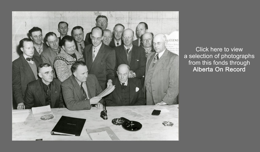
Back to Table of Contents
Series 301.05 Photographs. — 1914, 1951, [ca. 1978]. — 4 photographs.The series consists of three photographs: a panoramic view of the Town of Lake Saskatoon in 1914, a laminated poster of the First County Council in 1951 (2 copies), and an aerial of Clairmont taken ca. 1978.
Village of Lake Saskatoon, 1914
1 photograph; b & w; 2.5 x 6 in.
Panoramic view of the Village of Lake Saskatoon on the shores of Lake Saskatoon.
Location: 0301.05.01
First County Council, 1951
2 photographs; b & w ; sepia; 8 x 12 in
First County Council in 1951: middle row first left – Mel Howie, second form left moiddle row, Percy Johnson.
Location: 0301.05.02
Aerial of Clairmont, [ca. 1978]
1 negative; b & w; 9 x 9 in
Aerial photograph showing Clairmont and surrounding countryside. Identification number on the photo is NW 1041078.
Location: 0301.05.03
Back to Table of Contents